Technology
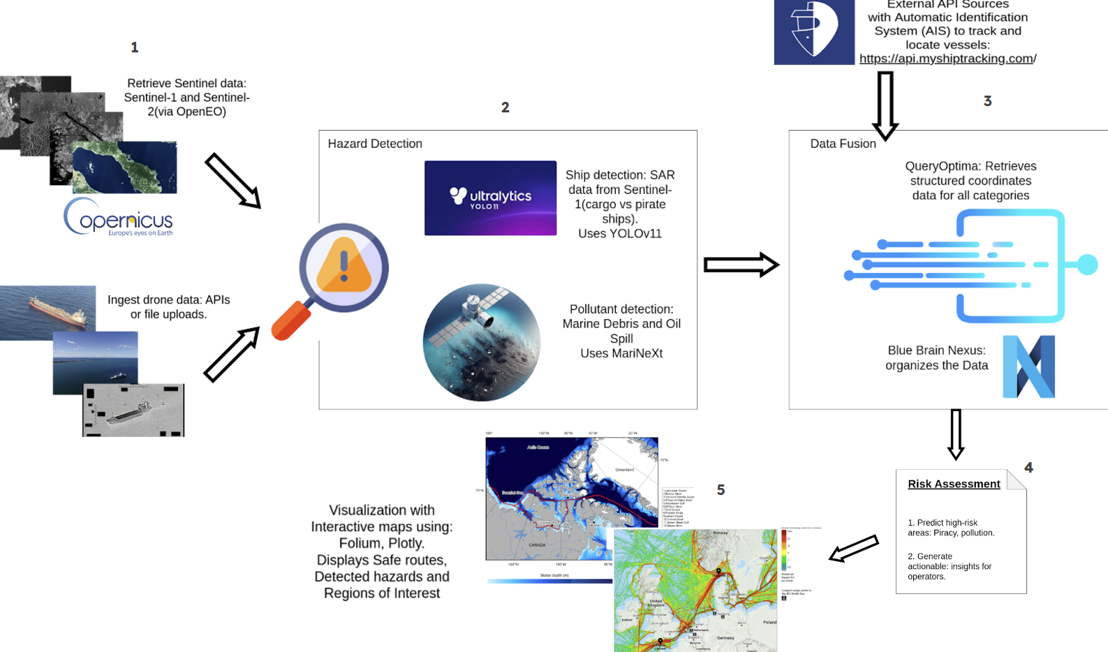
Our platform will combine QueryOptima and the Copernicus OpenEO API with other European Space Data Services into one pipeline, thereby making the processing of drone data and analytics smoother and operationally more effective in its applications for defense and civil protection.
We take satellite and drone data to detect cargo and pirate ships using the YOLOv11 object detection model and the MarinexT deep learning framework for identifying pollution, particularly marine debris and oil spills. Along with this, we use myshiptracking to obtain real-time ship movement data. After that we use our solution QueryOptima to normalize and structure the data and Blue Brain Nexus to embed it into a knowledge graph. Processed data is used for risk assessment, identification of safe routes and further visualization.